Photo Gallery
I've Guided Both Islands, Here's What 10 Years on These Trails Taught Me
I arrived on Tenerife in 2016 with a backpack and a pair of boots that fell apart on my third Teide ascent. I've since logged over 500 guided hikes across the Canaries, 200+ on Gran Canaria alone. I walked Roque Nublo at sunrise in February when the wind cut through three layers. I stood on Teide's summit in July at -5°C watching my water bottle freeze. I've taken beginners up Anaga cloud forests and watched experienced mountaineers drop from altitude sickness on the Teide cable car platform. I've guided the Teide summit hike more than 50 times and every client who skipped the permit ended up disappointed. Most comparisons online treat these islands as interchangeable. They're not. The tenerife vs gran canaria hiking question comes down to one thing: do you want altitude records and volcanic drama, or do you want a compact island where you can hike a different ecosystem every day without driving two hours?
Let me break it down with real numbers, specific trails, and honest tradeoffs, not the kind you get from someone who spent three days on each island for a blog post.
Tenerife: High-Altitude Drama with a Paperwork Barrier
Teide National Park Guided Hike
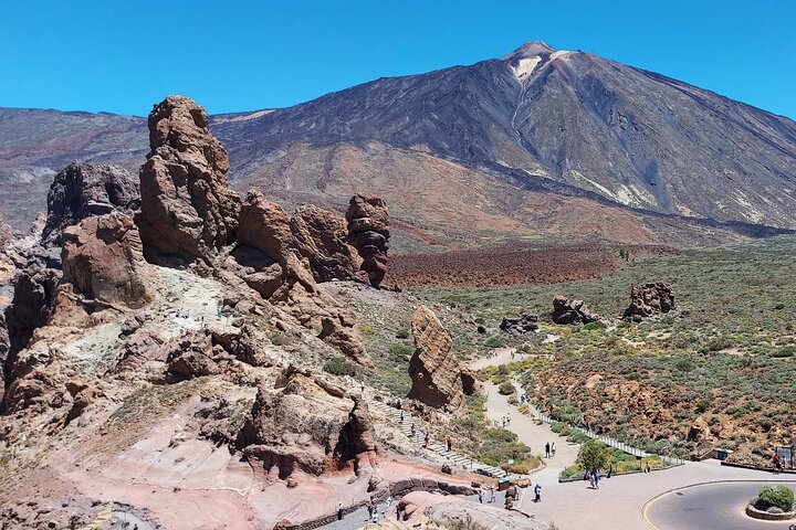
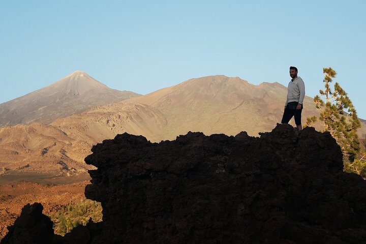
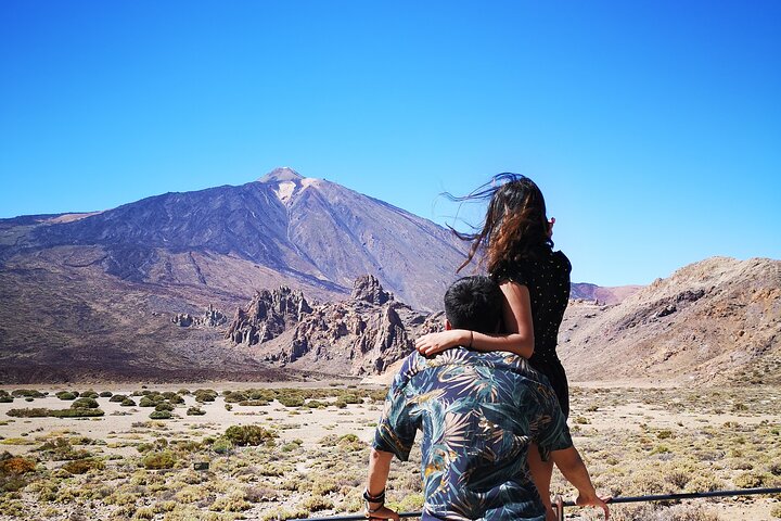
The definitive Tenerife experience. You start at 2,356m in the cable car station, hike through lunar landscapes to the summit crater at 3,715m. The permit system means you'll share the trail with about 30 people, not 300. Downside: the altitude hits hard, I've seen fit runners drop from headaches within 30 minutes of leaving the cable car.
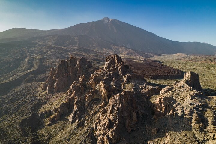
Book This Tour →Tenerife has 1,000 km of marked trails across 32 official Sendero routes. The crown jewel is Teide at 3,715m, Spain's highest peak and the third tallest volcanic structure on Earth measured from the ocean floor. I booked the Teide summit hike last winter and watched the shadow of the volcano stretch 180km across the Atlantic. But the permit system is a bottleneck: only 200 people per day get summit access, and they're free but require booking. Without the permit, you're stuck at the cable car station at 3,555m, still above the clouds, but not at the crater rim. During peak season (June–September), permits disappear 60 days in advance. If you don't plan ahead, you're not summiting.
The altitude range is unmatched in the Canaries. You can start your morning in a banana plantation at sea level in Puerto de la Cruz and be above the clouds by lunch. Anaga Rural Park in the northeast has laurel forests that feel prehistoric, moss-draped trees, permanent mist, trails that wind through tunnels of vegetation. The Masca Gorge drops 600m from a mountain hamlet to the Atlantic, and the Teno Massif gives you cliffs that rival anything in Madeira.
The downside is logistics. Getting from the southern resorts (Los Cristianos, Playa de las Américas) to the Teide cable car takes 75 minutes. Anaga is 90 minutes from the south. The best hiking is in the north and centre, while most accommodation is in the south. If you're staying in Costa Adeje without a car, you're looking at a €120 taxi or a guided tour with hotel pickup.
Who it's NOT for: Spontaneous hikers who hate advance planning. If the idea of booking a free permit 60 days ahead makes you angry, Tenerife's Teide zone will frustrate you. Also not for anyone who gets altitude sickness easily, I've had clients vomit at the cable car station at 3,555m, and that's before the 160m climb to the summit.
Gran Canaria: Compact, Spontaneous, and No Paperwork Required
Gran Canaria has approximately 1,200 km of marked trails packed into a much smaller landmass. What it lacks in altitude, Roque Nublo at 1,813m is the highest point, versus Teide's 3,715m, it makes up for in accessibility. I drove from Maspalomas beach to the Roque Nublo trailhead in 43 minutes last spring. On Tenerife, that same beach-to-mountain transition takes 75 minutes on a good day.
Gran Canaria's microclimate diversity is its superpower. In one day you can hike through palm-filled ravines in the south, pine forests in the centre, and volcanic craters at the summit, without driving more than 30 km between them. The island is a miniature continent. The north coast near Agaete has banana plantations and humidity that remind me of Madeira. The centre around Tejeda has crisp mountain air and almond trees. The south around Maspalomas is a desert with sand dunes that look like the Sahara. You can hike three distinct ecosystems before dinner.
The trail infrastructure is better for independent hikers. Signposting is clearer, the bus system (Global) reaches more trailheads, and there are more marked circular routes. On Tenerife, many of the best trails like Masca and Teide summit are point-to-point, requiring either a second car or a taxi back. On Gran Canaria, most popular routes are loops, park at the trailhead, hike, return to your car.
Who it's NOT for: Altitude chasers. Gran Canaria doesn't have a 3,000m+ peak. If you want to tick off Spain's highest mountain, this isn't your island. Also not for anyone seeking true wilderness, Gran Canaria is more populated in its interior than Tenerife, and you'll see villages and farms on most hikes.
The Morning That Settled It for Me
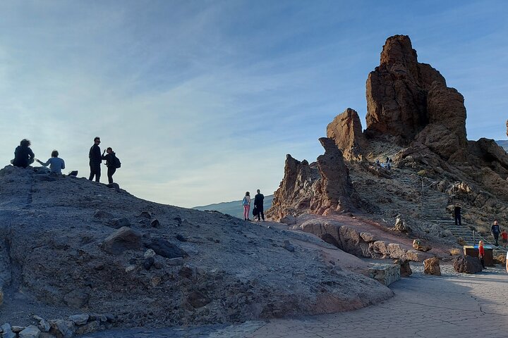
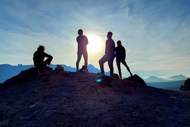
I spent a week on Gran Canaria last spring specifically to settle this comparison. On Tuesday at 06:15 I was driving up from Playa del Inglés. By 06:55 I was at the Roque Nublo trailhead at 1,600m. The trail is a 4km round trip with 200m elevation gain, easy enough that I passed a family with kids under 10 on the way up. By 07:30 I was standing alone at the base of the 66m volcanic monolith, watching the sun rise over the Atlantic. The wind was cold but manageable in a softshell. Seven other people arrived by 08:00. No permits, no queues, no stress. I was back in town eating tortilla and café con leche by 09:15.
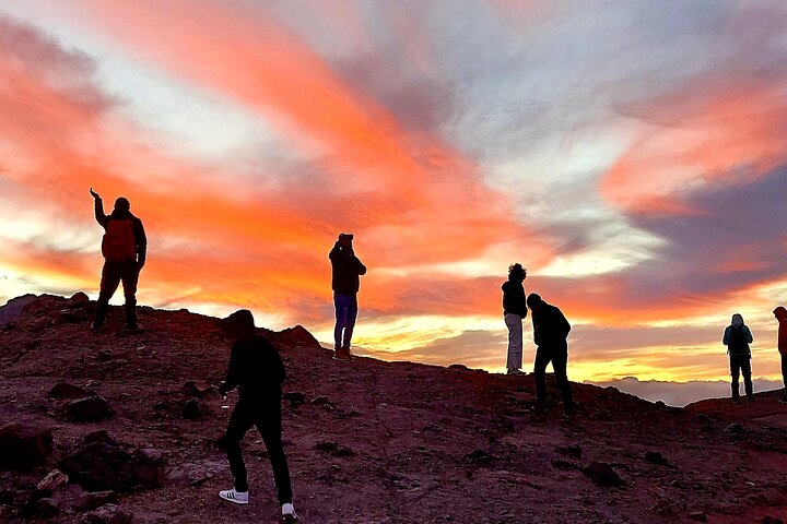
Compare that to the Teide summit hike I did in August 2024: permit booked in June, cable car ticket purchased separately, arrived at the base station at 08:30, shared the summit trail with 40 other permit holders, altitude headache kicked in at 3,600m, descended by 12:00, back at the coast by 14:00. Both were excellent experiences. One was a mission. The other was a morning walk.
I now recommend Gran Canaria to about 70% of casual hikers and 90% of first-time Canary Islands visitors. Tenerife wins for anyone who asks specifically about Teide, or for hikers who want the altitude achievement and don't mind the logistics.
Trail Comparison at a Glance
| Factor | Tenerife | Gran Canaria |
|---|---|---|
| Highest point | 3,715m (Teide) | 1,813m (Roque Nublo) |
| Marked trails | ~1,000 km | ~1,200 km |
| Permits required | Yes (Teide summit) | None |
| Beach-to-trail drive | 60-90 minutes | 30-50 minutes |
| Best for | Altitude, drama, achievement | Variety, spontaneity, ease |
| Trail types | Point-to-point dominant | Loop routes dominant |
| Bus access to trailheads | Limited (Titsa) | Good (Global) |
| Winter hiking | Snow on Teide (crampons needed) | Year-round, no snow |
What I Wish I'd Known Before Hiking Both Islands
Here's the practical stuff that matters more than the glossy blog comparisons:
- Check the Teide webcam before driving up. I've seen visitors drive 45 minutes from the south only to find the summit buried in cloud at 2,000m. The official Teide webcam updates every 10 minutes. Check it before you leave your hotel.
- Morning departures have calmer conditions on Teide. The wind picks up by 11:00 most days. The 08:00 cable car slot gives you the calmest ascent window. Afternoon gusts regularly exceed 50 km/h and can close the cable car.
- Underestimate the cold at 3,500m and you'll suffer. I wore a down jacket, thermal base layer, and windproof shell on Teide in July. The temperature at the summit was 4°C with 40 km/h wind, wind chill brought it below freezing. I passed someone in shorts and a t-shirt who turned back after 10 minutes.
- Gran Canaria's interior roads are winding but well-paved. The GC-60 to Roque Nublo has 20+ hairpin turns. If you get carsick, take the bus or book a guided tour with hotel pickup.
- Tenerife has three distinct climate zones. The north (Anaga, La Orotava) is often cloudy and humid. The centre (Teide, Las Cañadas) is alpine desert. The south (Los Cristianos, Costa Adeje) is dry and sunny. Check the forecast for the specific zone you're hiking, not "Tenerife" generally.
- Gran Canaria's signposting is genuinely better. Tenerife's Sendero markers can be faded or missing on less-trafficked routes. I've had to backtrack twice on the Anaga-Chasna trail because a marker post had fallen. On Gran Canaria, I've never lost a trail.
- If you're combining beach and hiking on the same day, Gran Canaria wins. The drive from Maspalomas dunes to Roque Nublo is 45 minutes. On Tenerife, getting from a southern beach to Anaga or Teide hiking is 75-90 minutes each way. That's three hours of driving for a hike.
My Verdict After 10 Years on Both Islands
If you want Spain's highest peak, volcanic craters, and the bragging rights of a 3,715m summit, book a Teide guided hike on Tenerife, just plan 60 days ahead for the permit. If you want variety, spontaneity, and the ability to hike three ecosystems before lunch without paperwork, Gran Canaria is the better choice for most visitors.
I've hiked both, guided both, and genuinely enjoy both for different reasons. The islands are 30 minutes apart by plane but feel like different countries when you're on the trail. Choose based on your priorities, altitude and achievement or variety and ease, not a generic blog post that spent two days on each island.
For a deeper look at Tenerife's internal hiking differences, read my Teno vs Anaga vs Teide comparison. For specific route recommendations, see the full Tenerife hiking guide.
Explore More
Related comparisons and guides: